Over the past few weeks, we’ve rolled out a set of updates in ArchiWise focused on one thing:
helping you evaluate sites faster and with more clarity.
From better filtering and new data layers to sunlight analysis and parcel-level insights, these updates are designed to reduce time spent on research and make early-stage decisions more reliable.
Here’s what’s new and how it improves your workflow.
See what actually happens on your site
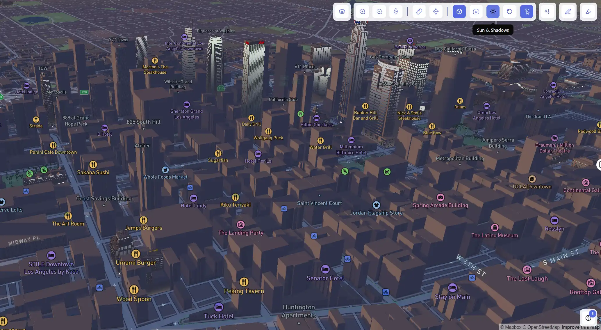
☀️ Sun & Shadows Tool

Understanding sunlight impact early can save major redesign later.
With the Sun & Shadows tool, you can see how shadows move throughout the day directly on the 3D map.
Use it to:
- Check sunlight exposure
- Understand how nearby buildings affect shading on your site
Instantly understand risk and opportunity
🗺️ New Map Layers

We’ve added new layers to give you a more complete picture of every location:
- Housing incentives (QCT, DDA, SB79, LIHTC)
- Hazards (fire, flood, seismic zones)
- Context layers (e.g. data centers nationwide)
- 12 ZIP-level demographic layers

Result:
You can quickly spot where a deal makes sense and where it doesn’t.
Find the right sites, not just more sites
🔍 Advanced Filters
Instead of scrolling through thousands of parcels, filter down to exactly what matters:
- Vacant, non-occupied, or government-owned parcels
- Search by owner name
- Filter by zoning code, land use, zoning type
- Demographics and proximity filters
Use it to:
- Find off-market opportunities
- Target highly specific development criteria
- Reduce time spent on irrelevant sites
Evaluate location the way people actually move
🚗 Travel Distance Tool
Distance isn’t linear – time is what matters.
Analyze areas based on real driving time (e.g. 10 minutes) to understand accessibility and value.

Analyze exactly the area you care about
✏️ Draw Area Tool

Not every opportunity fits a predefined boundary.
Draw custom areas directly on the map and screen parcels inside them.
Understand properties without visiting them
✨ Highlight Detection

Automatically detect features like:
- Pools
- Solar panels
- Courts
Use it to:
Quickly understand property characteristics at scale without manual inspection.
Turn insights into action
📤 Export & Save Parcels

Save selected parcels directly to your project or export them.
Result:
You can build and manage your deal pipeline without switching tools.
Faster due diligence, parcel by parcel
📊 Area Intelligence (Parcel-Level)
See hazards and demographics instantly for each parcel.
No need to jump between multiple tools.
What this really means
These updates aren’t just features.
They’re about reducing uncertainty at the earliest stage of development.
- Fewer bad acquisitions
- Less redesign
- Faster decisions
- Better outcomes
What’s next
We’re shipping new updates every week. If you have ideas, data requests, or workflows you want to improve – we’d love to hear from you.
ArchiWise helps developers, investors, architects, and brokers move beyond zoning theory and into parcel-level reality.
Whether evaluating land for housing, commercial projects, or infrastructure like data centers, ArchiWise provides decision-ready intelligence before time and capital are committed.
Explore how ArchiWise helps teams analyze real sites and make smarter development decisions.